Watershed Services Project
Johns Island Restoration Plan
Project Details
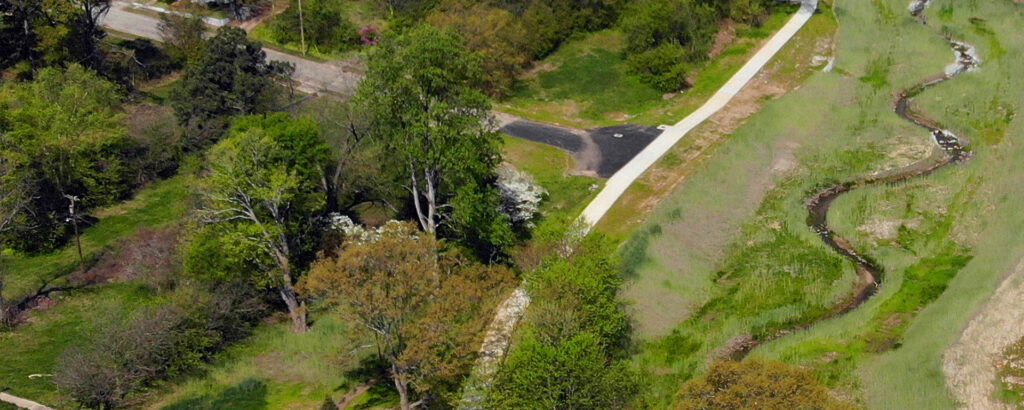
Johns Island continues to be a magnet for new residential development despite endemic flooding. The island’s tides, elevations, and climate all control surface hydrology such that significant risks to public safety and private property occur from frequent summer and less frequent tropical storms.
The City of Charleston has adopted a highly proactive approach to flood resiliency based on Dutch concepts of Living with Water. It’s a new way of thinking about water, land, and people that leverage the compound values of natural systems. WK Dickson led a team of international experts to develop the Johns Island Restoration Plan, Charleston’s first localized application of a comprehensive approach that integrates the restoration and protection of natural ecosystems with community goals and future real estate development.
Starting with an elevation-based flood risk model, the WK Dickson team combined complex spatial analyses and engineering studies, public outreach, close work with residents and technical experts, and field assessments. An existing rain-on-grid H&H model was updated with the latest LiDAR and revised rainfall amounts, and integrated the city’s new sea level rise predictions. Cutting-edge risk assessment tools such as AccelAdapt were used to evaluate flood response and recovery challenges.
The Johns Island plan presents policy and project strategies to reduce environmental impacts from new development and leverage ecosystems and natural processes to mitigate flood risk. High-priority projects were identified and conceived to be compatible with the city’s new comprehensive plan that emphasizes three commercial hubs on the island. Both policy frameworks and project concepts were attentive to community priorities for greenways and open space.
WK Dickson also assisted the city in maintaining compliance with the National Fish and Wildlife Foundation grant for the project. Stakeholder outreach included a technical advisory group with participation from ten government entities from the city, county, state, and federal agencies.

Ecosystems provide regulating services for the storage and conveyance of stormwater, so the preservation, restoration, and stewardship of these natural systems are essential components of a sustainable flood mitigation and management plan.
Gallery